
Using any of the Terrain editing tools is very simple. You will literally paint the Terrain from within the Scene View. For the height tools and all others, you just have to select the tool, and click the Terrain in Scene View to manipulate it in real-time.
所有地形编辑工具的使用都很简单,你可以直观的在场景视图中绘制你的地形,使用高度工具或其他工具,你只需选中那个工具,然后在场景视图中点击你的地形即可实时操作了。
Raising & Lowering Height 升高和降低高度
The first tool on the left is the Raise Height tool  .
.
With this tool, you paint brush strokes that will raise the height of the Terrain. Clicking the mouse once will increment the height. Keeping the mouse button depressed and moving the mouse will continually raise the height until the maximum height is reached.
左边第一个工具是 升高工具,使用这个工具你在地形上绘制时会根据笔触升高地形。单击鼠标会增加高度,保持鼠标按下状态移动鼠标会不断的升高高度直到达到高度的最大值。
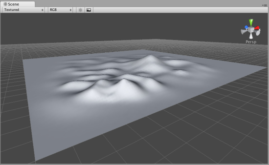
You can use any of the brushes to achieve different results
你可以使用不同的笔刷来实现不同的结果。
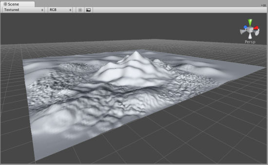
If you want to lower the height when you click, hold the Shift key.
如果你想要降低高度,按住Shift键再点击鼠标。
Note:When you have a brush selected, move your mouse over the Terrain in the Scene View and press F. This will center the Scene View over the mouse pointer position and automatically zoom in to the Brush Size distance. This is the quickest & easiest way to navigate around your Terrain while creating it.
注意:当你选中一个笔刷后,在场景视图中把鼠标移动到地形上然后按F键将会以你的鼠标位置为准居中场景并且会自动缩放到笔刷尺寸的距离。这是创建地形过程中在地形上导航最快且最容易的方法。
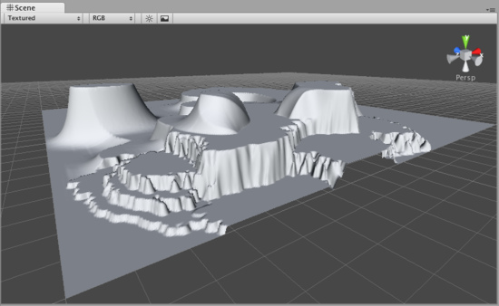
Paint Height 绘制高度
The second tool from the left is the Paint Height tool  .
.
This tool allows you to specify a target height, and move any part of the terrain toward that height. Once the terrain reaches the target height, it will stop moving and rest at that height.
左数第二个工具是绘制高度工具,这个工具允许你指定一个高度,然后移动地形上任意部分达到这个高度,当地形达到这个高度以后,它将停止移动并且重置高度。
To specify the target height, hold Shift and click on the terrain at the height you desire. You can also manually adjust the Height slider in the Inspector.
想要指定高度,按住Shift键然后在地形上点击你想要的高度位置,你也可以在监视窗中手动调整高度滑块。

Now you've specified the target height, and any clicks you make on the terrain will move the terrain up or down to reach that height.
现在你指定了目标高度,之后你再点击你的地形是就会使地形相应的位置升高或降低到指定的高度。
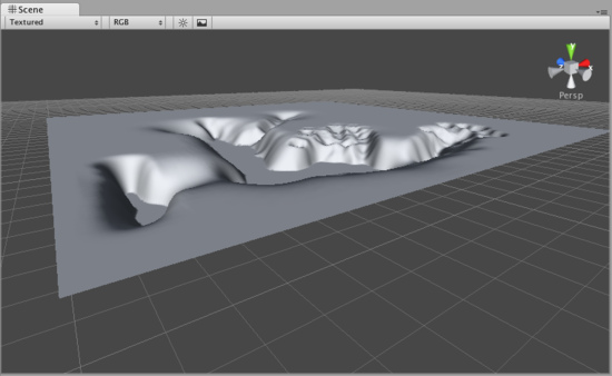
Smoothing Height 平滑高度
The third tool from the left is the Smoothing Height tool  .
.
This tool allows you to soften any height differences within the area you're painting. Like the other brushes, paint the areas you want to smooth in the Scene View.
左数第三个工具是平滑高度工具,这个工具允许你柔化你绘制的区域的高度差,像其他笔刷一样,在场景视图中绘制你想要进行平滑的区域。

Working with Heightmaps 使用高度图
If you like, you can import a greyscale Heightmap created in Photoshop, or from real-world geography data and apply it to your Terrain. To do this, choose Terrain->Import Heightmap - Raw..., then select the desired RAW file. You'll then see some import settings. These will be set for you, but you have the option of changing the size of your Terrain from this dialog if you like. When you're ready, click the Import button. Once the Heightmap has been applied to the Terrain, you can edit it normally with all the Tools described above. Note that the Unity Heightmap importer can only import grayscale raw files. Thus you can't create a raw heightmap using RGB channels, you must use grayscale.
如果你愿意,你可以导入一个使用photoshop创建的或来自现实地理数据的灰度高度图来应用到你的地形。想要导入高度图,请在在菜单中选择Terrain->Import Heightmap - Raw..., ,然后选择想要的RAW文件,你将会看到一些导入设置,这些都已经为你设置好了,你可以随意的通过对话框中的选项改变地形的大小。当你准备好以后,点击Import按钮,当高度图被应用到地形以后,你可以正常的使用所有以上介绍的工具对它进行编辑。注意Unity高度图导入器只能导入灰度raw文件,因此你不能创建一个带有RGB通道的raw高度图,你必须使用灰度模式。
Unity works with RAW files which make use of full 16-bit resolution. Any other heightmap editing application like Bryce, Terragen, or Photoshop can work with a Unity Heightmap at full resolution.
Unity使用全16位分辨率的RAW文件,任何高度图编辑工具如Bryce,Terragen或Photoshop都可以使用全分辨率生成Unity高度图。
You also have the option of exporting your Heightmap to RAW format. Choose Terrain->Export Heightmap - Raw... and you'll see a export settings dialog. Make any changes you like, and click Export to save your new Heightmap.
你也可以设置导出你的高度图为RAW格式,选择菜单中的Terrain->Export Heightmap - Raw...之后你会看到导出设置对话框。随意改变其中的属性,然后点击Export按钮保存你的新高度图。
Unity also provides an easy way to flatten your terrain. Choose Terrain->Flatten.... This lets you flatten your terrain to a height you specify in the wizard.
Unity也提供一个简单的方法来弄平你的地形,选择菜单中的Terrain->Flatten....就可以使你弄平你的地形到你在向导中指定的高度。
This feature is currently not available for iOS targets.
此功能目前不支持iOS。
This feature is currently not supported by Android targets.
此功能目前不支持Android。
页面最后更新: 2011-02-20